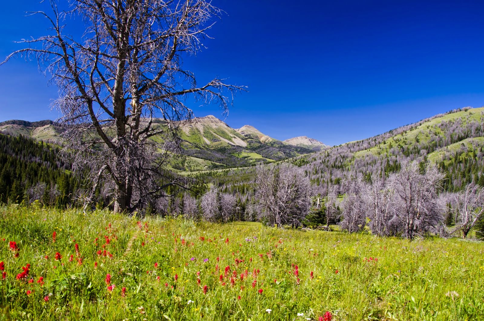
Section 5: Mammoth Lakes to Tuolumne Meadows
Theme: Wind/Fire, The "Next Time" leg
Soundtrack: Dead Flowers- The Rolling Stones, Waiting for the Sun- The Doors
Map Part 1 (link)
Map Part 2 (link)
 |
| Good morning! |
Day 29, August 27
Devil's Postpile to Minaret Lake
Today, we would begin our final leg of our journey. Our time in Mammoth had been enjoyable, as far as time in civilization is concerned, but once again, I couldn't wait to get back out into the backcountry. Minaret Lake would be our destination today, though we still weren't sure how we were going to get there. Ordinarily, one can simply follow a trail the entire way to the lake, but the official High Route branches off, leading to cross country travel over Nancy Pass and through the basin just east of Deadhorse Lake. While that option certainly appeared to be more interesting and scenic, it would mean a longer day, requiring an early start and plenty of ambition.
We were awake at a fairly reasonable time, but unfortunately, we were both feeling the effects of our margaritas last night. We weren't going to do anything until we found some coffee. Then, of course we needed some pastries to eat with it, which we were fortunate enough to find right across the street form the hotel. It was a slow morning in general, but all in all, we were pretty ok with it.
We finally arrived, stocked with coffee, croissants and oranges, at the Reds Meadow shuttle at around 11:00. For those that don't know, personal vehicle travel is highly regulated on the stretch of road between Mammoth and these trailheads. Instead, inexpensive shuttles are the primary means of access here. This, along with the free buses throughout Mammoth, were extremely helpful to us as we had no vehicles of our own at this point.
By the time we started hiking, it was after 12:00. We made the easy decision to stick to the trail en route to Minaret Lake, but not before first running over to check out Devil's Postpile. A cool formation for sure, and the perfect display of columnar basalt definitely awakened the geologist in me. Strangely, I took no pictures here. It may have had something to do with all of the other people scurrying around the area.
 |
| Falls on Minaret Lake Trail |
|
Regardless, it was time to set out on our final leg. For most of the walk, we were on a mellow trail, strolling through timber, occasionally glancing up at the clouds and peaks to the west. We moved fairly quickly up the JMT (on which surprisingly, we saw no other humans) before turning west on the Minaret Lake Trail and heading toward the final switchbacks below the lake.
 |
| Minarets from the top of the switchbacks |
|
The final push took us up and into some pretty dramatic country. As beautiful as they are, the Minarets have a certain sinister, unforgiving look to them, and as they stood there beneath the cloud cover that they'd held onto all afternoon, glaring down at us, we knew full well that we were in their world now. Of course, I was overjoyed by this and after spending a few minutes to fully appreciate our environment, we set off to make ourselves at home.
 |
| Home at Minaret Lake |
|
Day 30, August 28
Minaret Lake to Nydiver Lakes
I had some big plans today, so it was early to rise. My sites were set on Volcanic Ridge and I was hoping to make it to the top by sunrise. Oddly (or not), I slept in a bit longer than anticipated, resulting a quick granola bar breakfast and a mad scramble to get the essentials into the flash pack. Jen took one quick look before informing me that she was happy to enjoy some more sleep and a leisurely morning around camp. That sounded nice as well, but I was eager to get moving.
The climb itself was fairly straightforward, first up some dewy green stuff, then onto varying talus. Nothing overly exciting, but thoughts of catching my first up-close views of Ritter and Banner glowing in the morning sun provided all the energy I needed as I worked my way up. In the end, the sun beat me to the top by about 15 minutes, but I didn't let that dampen my spirits. The view was spectacular. Almost our entire day's route was laid out in front of me, the morning light reflected beautifully off of the the Minarets, and Ritter and Banner were now right in front of me. Ever since we stood on top of Goddard a couple weeks ago, whenever we found ourselves at any vantage point, these two peaks would make sure that they could be seen. Oddly, today they were acting surprisingly shy. Ritter was breaking a steady cloud stream and the two of them tried to stay hidden for much of the time that I was up there. I suppose it was a bit windy and chilly. Maybe they just weren't quite ready to wake up yet.
 |
| A quick appearance from Ritter and Banner |
|
 |
| Morning sun on the Minarets |
|
 |
| Our route for the day. Cecile and Iceberg Lakes are left and centerish. Lake Ediza is at the far right. Nydiver Lakes our home for tonight are on the bench above Lake Ediza. |
What an incredible atmosphere. The sun and wind and clouds and crisp morning air combined with the incredible view of the surrounding area to provide a full on immersive experience. I was only a day away from civilization, but I may as well have been a hundred. It was a brand new day and as I sat there staring into the future, regular life was completely non-existent once again. Fantastic. Of course, I could have spent the rest of the day up here, but eventually the wind told me that it was time to move on, so I obliged and began heading down.
 |
| Descending to Minaret Lake |
|
When I arrived back home, Jen was already up and moving. We did up a breakfast and I took a little walk along the lakeshore before packing up and setting out on our way. We really didn't have far to go today, but we were expecting a lot of breaks given the wonderful country we were about to traverse.
 |
| Minaret Lake |
|
The initial climb up the inlet stream toward Cecile Lake was reasonable enough as we followed a use trail most of the way. The quick bit of class three work at the top was interesting, but not overly difficult, and we were soon picking our way along the lakeshore. Clyde Minaret completely stole the show here. After every few steps, I found myself stopping to stare over to him, completely awestruck in his presence. Once again, I took a ton of photos and none of them even come close to conveying the nature of the scene.
 |
| Clyde | |
After reaching the outlet and descending a steep chute (not the preferred route) to Iceberg lake, we traversed over and down to another ideal lunch spot. The wind was still ripping, but it the scenery trumped it and we relaxed for awhile, staring back and appreciating where we'd just been.
 |
| Iceberg Lake |
It was still fairly early, so we decided to take a little detour down to Lake Ediza. Sometimes, you just can't get enough pleasant wonderland strolling. We took it easy, walking completely around the lake before heading east up the cascading inlet stream toward Ritter and Banner.
 |
| Ritter and Banner |
|
|
Soon, we were heading up to Nydiver Lakes, our home for the night. After studying maps all spring, I had high hopes for these lakes. They didn't disappoint. We found another spectacular site between the two upper lakes and quickly set up camp. Then, it was off to explore the area. I love this part of the day. I love getting to know my new home, learning it and experiencing all that it has to offer. It's the difference between feeling like a visitor and actually becoming a part of it. Anyway, after checking out the lower lake, we headed for the edge of the bench, finding a fantastic overlook of the basin we'd just been strolling through.
 |
| Our overlook. |
|
When we couldn't resist our hunger any longer, we headed back to camp to do up some dinner. As usual, when the sun went down, so did we. As usual, it had been a fantastic day.
Day 31, August 29
Nydiver Lakes to Lower Twin Island Lake
Big day today and it couldn't have started any better. I unzipped my tent to find some unreal alpenglow on Ritter and Banner. I quickly threw some clothes on and grabbed the camera. The morning air was crisp and invigorating (and I'm far from a morning person), and even with the slight breeze, it was so quiet that I found myself inadvertently tip-toeing around in an effort to keep from disturbing the peacefulness of it all.
 |
| Morning at Nydiver Lakes |
|
Upon returning from my morning stroll, I found that Jen had awakened, so we enjoyed a relaxed breakfast before breaking camp and starting on our way. The beginning of the day was plenty nice. The ascent and descent of Whitebark Pass proved to be straightforward. I'm sure the lack of a snowfield on the north side played some role in that. The view from the pass wasn't overly memorable, but that was mostly due to the fact that it had been consistently fantastic from the moment we awoke. At the top, it was really just more of the same. Rough, I know.
 |
| Looking back from near the pass |
|
When we reached the floor of Garnet Basin, I couldn't help but detour down a little bit towards the water. I feel like Banner is usually overshadowed by his slightly loftier neighbor, but here, that wasn't the case. This was definitely his basin. It was nice to see him completely in his own element and I couldn't help but snap photo after photo of him rising above the water.
 |
| Banner Peak |
|
|
Once I'd had my fill of the basin, we strolled over Garnet Pass (probably the easiest pass of the trip) and down to the head of Thousand Island Lake where we took a little break on one of those ideal meadowy shoreline areas, accidentally startling a couple that was just breaking camp. Gotta give them props. They did well to hide in the trees nearby and we never even would have known they were there. Turns out, they were damned cool, and after sharing a few stories, a little advice, and some other stuff, we parted ways, continuing on in opposite directions.
 |
| Banner from the head of Thousand Island Lake |
|
Time for another climb, our third pass of the morning and most significant in terms of elevation. It started out rather nicely as we followed a stream upward through some nice country full of flowers that were a couple weeks past their prime. I can only imagine this area when they are at their peak. Then, when the pleasant terrain gave way to talus, the wind began to really pick up. As we continued our ascent, we passed a small group out on a day hike from Thousand Island Lake. They had planned to hang out at Lake Catherine, but the wind at the pass stopped them in their tracks. I thought it was a pain already, but they assured me that it was about to get much worse.
Once I finally topped out on the pass, I got a dose of what I'd been warned about. It was a full on fight. Generally, when confronted with crazy wind, I try to stare right into the teeth of it, hold my own, and keep my cool in an effort to outlast it, or at least show it that we can coexist, that it doesn't have to act all tough around me. I tried that method for awhile up here as I waited for Jen to top out. I was calm and collected, just hanging out and standing my ground, but eventually it won. I guess everyone has their breaking point. When Jen rolled up, I was hiding behind a rock outcrop, fully engaged in an obnoxious shouting match (it won that fight too). Jen and I tried yelling a few things back and forth, but neither of us could hear the other, so after watching each other get blown around a bit, we quickly began to head down and toward the lake outlet.
 |
| Lake Catherine |
|
Now, this was another spot I'd been looking forward to for a long time, and wind be damned, we were going to enjoy it. It was certainly every bit as stunning as I'd hoped and the whitecaps actually added a nice unexpected element to the scene. Even better, by the time we reached the outlet, we found that we were actually relatively sheltered. Perfect time for a lunch break.
 |
| Looking back toward Lake Catherine |
|
After a nice lunch and a quick walk over to check out a Ritter Lake, it was time to descend a waterfall. This is generally considered one of the more complicated parts of the High Route and I was looking forward to solving the puzzle. I absolutely love these kinds of route finding problems and we really hadn't seen this kind of rugged terrain since Ionian basin. The initial waterfall descent was otherworldly. We were picking our way down through the kind of place that no human could possibly dream up on their own. When we reached the meadowy bench above a 400 foot drop, we couldn't help but take another short break to absorb what we'd just experienced.
 |
| Waterfall Route |
|
 |
| Our first good look at Twin Island Lakes |
From here, our route strayed from Roper's somewhat partly due to a misinterpretation of some advice and partly due to our not consulting the book. Rather than continue our descent, we traversed over toward the red cliffs, continued west, dropped some interesting cliffs, and eventually ended up on some talus that led down to the inlet stream above the northern Twin Island Lake. While this wasn't done on purpose, it actually worked out in our favor as we were planning to stay up here anyway. After dropping our packs at the inlet, we wandered around for awhile, eventually deciding to set up just beyond the head of the lake.
 |
| Home for the next two nights |
|
Another early arrival meant that we had plenty of time to go and check the place out. I was hoping to catch a nice alpenglow view from one of the points east of the lakes. Turns out, Jen was down as well, so we decided to make a night out of it. After setting up camp and taking some time to get comfortable in our new home, we grabbed a few things and prepared for an evening out. We weren't too excited about fording the outlet, so it seemed worthwhile to scout the route around the west side of the northern lake. Turns out, the most troublesome section proved to be loose talus right off the bat on the northwestern shore. Once that was negotiated, the little bit of up and down on small cliffs proved to be interesting and entertaining.
In the end, none of this mattered as it was late season and the outlet stream was easily rock hopped. Neither of us had any desire to deal with the loose stuff on the northwest shore again, so our future route was decided. Upon reaching the shore of the higher lake, we immediately aimed for the highest point that we could see. It wasn't long before we were enjoying our dinner in one of the most beautiful dining areas on the planet. It's near impossible to describe these kinds of scenes. We just sat there, mostly silently, cooking, then enjoying our meal, staring out at the ridiculous alpenglow show, reflecting on everything else that we'd experienced so far. These are the moments that you never ever forget.
 |
| Mt Ritter glowing again |
|
Of course, once darkness began to creep in, we knew it was time to go. It was a bit of a walk back home, but we made it just as headlamps were becoming essential. It was nice to get to sleep knowing that we had no specific agenda tomorrow.
Day 32, August 30
Twin Island Lake Base Camp
I didn't know it yet, but today would prove to be a culmination day of sorts. It was the only day that I would not have to break camp or shoulder my backpack. It was to be a day of pure exploration. No specific agendas or goals. No worries about waking up in time or finding the perfect campsite. Today was about complete and absolute freedom.
 |
| Upper Twin Island Basin |
|
As a result, we slept until we were cooking in our tents again. Then, a very leisurely breakfast. After spending a little bit of time checking out the maps, we determined a general route into and around the Upper Twin Island Basin. Then, we loaded up the flash packs with supplies for the day and set out to explore.
We began hiking up our lake's inlet stream, choosing to follow the left branch, and soon finding ourselves in a gorgeous stream corridor. This really felt like a hallway of sorts, an actual gateway into the upper basin.
 |
| Our gateway into the upper basin |
|
Then, it opened up and everything hit me at once. We made it. Today was what this entire trip was all about. This place was fantastic and we could go anywhere we wanted, see whatever we wanted to see. No humans. No trails. No outside world. Just complete immersion into paradise.
 |
| Opening up to paradise |
|
I'm not going to get too detailed here, but suffice it to say that we visited almost every lake in that basin. At one point, I thought about going up Rodgers Peak, who seemed to demand our attention for most of the day, but decided that would force us to blow by too many other great spots. As for highlights, we began by heading west to the lakes beneath Electra Peak, where we drank some of the best water I had on the entire trip.
 |
| Electra Lakes |
|
Then we headed north, grabbing lunch by Drumstick Lake (3180+).
 |
| Drumstick Lake outlet |
|
 |
| Mt Rodgers above Drumstick Lake |
|
Then, up to the surprisingly scenic upper lake at the head of the valley.
 |
| Rocky Lake |
|
On the way down, we enjoyed some connect-the-dots style bench ponds before staying east and strolling by Lakes 3119 (full of tadpoles with legs, a new one for me) and 3108.
 |
| Looking down to Dotted Bench and beyond from Rocky Lake |
 |
| Looking south from the edge of Dotted Bench. We ate lunch between the two closest lakes. Our exit lies beyond the farthest lake. Strangely, the middle lake is nowhere to be found on the USGS maps. It was thus named Lake Forgotten. |
 |
| An explorer's paradise |
|
Our exit proved to be very similar to our entrance as we found ourselves in another gateway like stream corridor leading us out and down toward our home.
 |
| Almost home |
|
It was another perfect day. Another incredible dance through stunning country. Routefinding was straightforward for the most part and we generally just read the terrain and made decisions as we went, finding that the environment seemed to agree with us every time. We were a part of this place and it was happy to have us.
After dinner, I couldn't help but head back up to a high point for another look at the alpenglow on the Ritter Range. Definitely worth it. In the end though, even without the packs, it had been a long day. Sleep came early and easy.
Day 33, August 31
Twin Island Lake to Blue Lake
Holy smoke! I smelled it before even leaving the tent. The haze had rolled in overnight and we were about to be subjected to a whole new type of environment. We knew full well that the Rim Fire was raging in northwestern Yosemite, but until now, it had affected us very little. It was about to make up for that today.
We didn't really have much of an itinerary for these final few days and today's destination was kind of up in the air. I did know that I was pretty excited to check out Bench Canyon. I figured that if it was everything I'd heard, we may be spending a good part of the day relaxing and dancing our way through it. But first, we had to traverse the lakes and wander across an open hillside in order to make our way over there.
 |
| Looking back toward the upper basin from above Lower Twin Island Lake |
|
After learning that we could rock hop the outlet stream of our lake, we decided to make our way along the eastern shore en route to the upper Twin Island Lake. The beautiful look back down toward our former home and further into Upper Twin Island Basin that I remembered from a couple nights ago was slightly marred today by the smoky haze that had finally found its way to us. Of course, I figured morning light would make for better photos here, so I neglected to take any the other night. Now, I had to settle for the current conditions. Lesson learned, I suppose.
 |
| Looking back form between the lakes |
|
 |
| Jen at Upper Twin Island Lake |
|
|
|
When we reached the saddle above the head of the lake, we couldn't help but quickly run up Peak 9968 (a suggestion in the Roper book) for another nice view of the Ritter Range and the immediate valleys below. After that quick trip, we made the straightforward traverse over to the next small lake, taking a short break to hang out with the horde of small frogs and legged tadpoles.
Throughout the morning, we were noticing more and more smoke rolling in, but until now, it had mostly just left us in a mild haze. We knew that was about to change however, when we got our first view of the head of our destination valley. Smoke tumbled like a waterfall over the ridge above Blue Lake, slowly filling the upper reaches of the valley. Any excitement about reaching Blue Lake gave way to disappointment and apprehension. At this rate, by the time we got there, it would be completely intolerable.
 |
| That's where we're headed |
Still, we continued on, side-hilling our way over to a reasonable place to begin our descent into Bench Canyon. Throughout much of this leg, it was evident that we were visiting late in the season. Multiple times, I found myself saying "I can't wait to come back and see this place when it's at its peak." Now that we'd made our way into Bench Canyon, plans for a future trip were cemented. The smoke certainly played a part, but what has always been described as a fairy land was coming across as more of a post-apocalyptic wasteland. The brown meadows and brown skies gave it the appearance of being completely devoid of life. Super eerie and kind of cool in a way, but this place most definitely wasn't exhibiting its true self.
As we were eating lunch at a stagnant pool, another group passed by us, heading down valley. They were originally heading for Blue Lake Pass, but the smoke was just too much for them (and the small child they had in a carrier). We took that as a pretty clear indicator that we wouldn't be going much farther today. When we reached the base of the climb to Blue Lake and looked up at the dense smoke at the head of the valley, we decided that it would be in our best interest to stop where we were.
 |
| Not very welcoming |
|
We dropped the packs, ate some snacks, and played cards, all the while occasionally glancing up in hopes that the smoke would thin out somewhat. Ultimately, after a few hours (and one of the most awesome comebacks in cribbage history), it did. Or at least it thinned out to about the same levels as the area where we'd been sitting. We decided to go for it, figuring that if nothing else, the campsites would be better up there. Continuing to the pass was certainly out of the question, but at least we could find a nice home.
In the end, the landscape around Blue Lake is absolutely gorgeous, even without a view out to our surroundings. Giant boulders and green walkways made for an amazing immediate area. Even in the smoky environment, I couldn't help but explore our home, finding all kinds of fun little nooks and outcrop points. After checking out both lakes and everything between them, we pitched our tents just above the lower lake, where we had a pretty awesome view over it to... well... nothing at all.
 |
| Our infinity pool |
Day 34, September 1
Blue Lake to Vogelsang Lake
Well, it all changed overnight. I awoke to a perfectly still morning, not a hint of smoke in the air. I looked out over the lake to see the Ritter Range splitting clouds again, much the way it was back on day 2 of this leg. Stunning. I had all the inspiration I needed to get up and moving. Again, we weren't exactly sure where we would end up today. We did know that we were only two more days from civilization and today would mark the end of our cross country travel.
 |
| So that's what we were missing |
We took it fairly easy and by the time we got moving, a number of gray clouds had moved in, but that was still preferable to the smoke from yesterday. First on the agenda was an ascent of Blue Lake Pass. It proved to be a bit more time consuming than expected, but by staying far right on the lower section, then traversing back left to the pass itself, it offered little in the way of technical difficulty.
 |
| Blue Lake and his higher neighbor from near Blue Lake Pass |
|
We reached the top and took in our first unobstructed view into Yosemite, and while the cloud cover may have hindered it somewhat, we were plenty pleased with what we saw. Every pass obviously marks a divide of sorts, but this one felt major. Yes, we were crossing a man made boundary, but it was much more than that. The terrain completely changed as well. We were looking out over a wide expanse into the land of domes and U-shaped granite valleys.
After descending to the lake below, I decided to take a quick jaunt up to Foerster Ridge to get a look down into the Upper Lyell Fork Basin. This was originally on the side trip list, but due to some other delays earlier, it just wasn't possible this time. The ridge would have to suffice. When we reached our viewpoint, I knew I had yet another reason to come back and run this stretch again. I could have a lot of fun running around down there.
 |
| Upper Lyell Fork basin just begging to be explored |
Alas, this time, we had to turn around and continue on our way. We strolled back across the basin before following a drainage down to the lake directly below it. From here, we made our way over to trail, the first we'd seen since day 2 of this leg. We wouldn't leave it again until we reached my car tomorrow.
 |
| More nice water |
Much of the rest of the day was fairly uneventful. We headed north and descended to the river, catching a few nice glimpses of the canyon and upper basin as we did so. After climbing back up to the north rim, I was excited at the potential for nice views the entire way over toward the Lewis Creek Junction.
 |
| Above the Lyell Fork |
|
Well, this proved to be one of the only times this trip that I was truly disappointed. Here we were traversing above a gorgeous canyon with potential expansive views beyond, but the trail kept us just off of the rim and in the timber, away from any kind of vistas at all. Jen suggested the only reasonable explanation. Maybe this trail was built with horse travel in mind. The shade and softer ground would certainly be much easier on them. At any rate, I just went into mile burning mode and lead the way down to the next junction. Fortunately, we found the Lewis Creek Trail to be much nicer as it followed a cascade most of the way before reaching timberline again near Vogelsang Pass.
 |
| Looking back from near Vogelsang Pass |
|
Once we reached the pass, we were both pretty beat from the fast paced trail miles and found joy in the fact that Vogelsang Lake looked close enough to touch. Upon reaching its shores, we found even more joy in the lack of any other humans nearby. It was an absolutely beautiful night, in one last beautiful home.
 |
| One last home |
|
|
Day 35, September 2
Vogelsang Lake to Tuolumne Meadows
Time to leave. It was hard to grasp the fact that I'd just spent my last night in the backcountry. It was even harder to grasp the fact that I was supposed to be at work in Missoula tomorrow morning. I tried not to think about these things as we packed up our gear one last time. As we walked out on the Rafferty Creek Trail, I couldn't help but reflect on everything that I'd seen and learned, the connections I'd made, crazy surprises, and the overall evolution of my mindset out here. It was like the trip was already over. Thoughts from regular life that rested dormant for the past month came flooding back into my mind and I couldn't even begin to address them. I wasn't ready to go back to that life. This new one had been ideal and now I had to pull myself away from it. I just kind of walked, mostly unaware of my surroundings, until we reached the trailhead.
 |
| Rafferty Creek Trail |
Once we saw the car, it was over for real. Done. Just like that. Now what? I guess I had a nice long drive ahead of me. I could certainly use it to try to sort myself out before being thrown back into regular life again. After picking up Jen's car at North Lake and grabbing a quick meal, we said a final goodbye to this incredible place and set off toward Monana.